
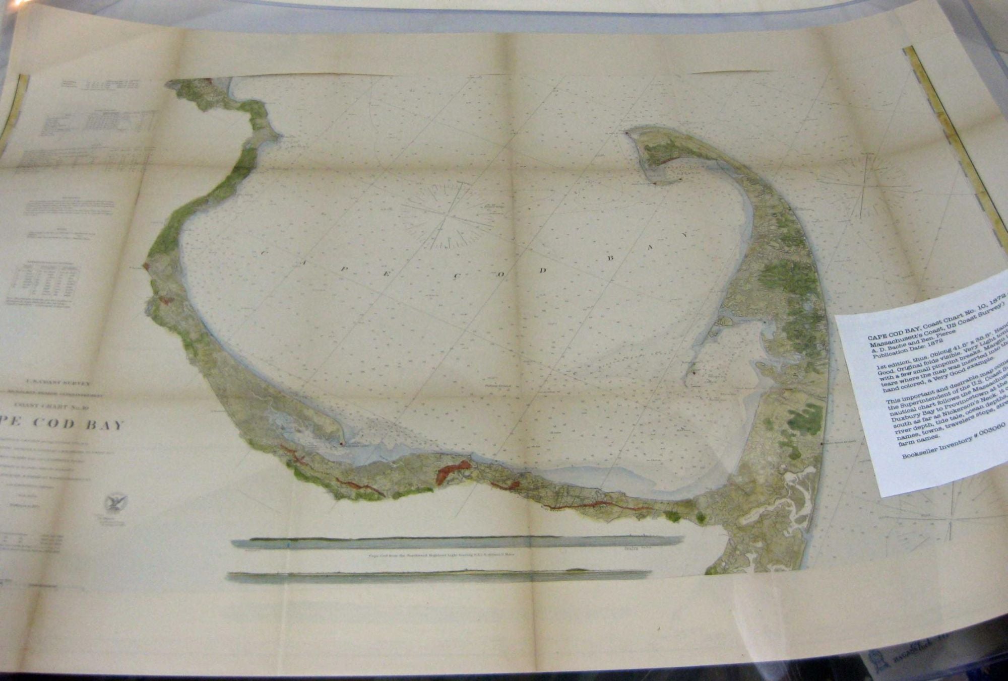
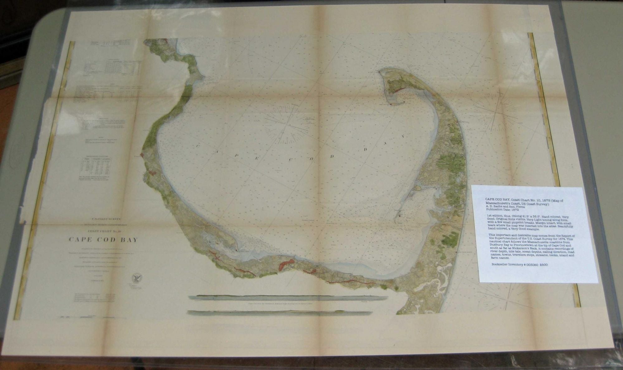
CAPE COD BAY, Coast Chart No. 10, 1872 (Map of Massachusett's Coast, US Coast Survey)
(Wash. D.C.): U.S. Coast Survey Office, 1872. Imperial Edition. Map. Double Elephant - over 25 - 50" tall. Very Good. Item #003060
1st edition, thus. Oblong 41.5" x 35.5". Hand colored. Very Good. Original folds visible. Very Light toning along folds, with a few small pinpoint breaks. Margin intact, with small tears where the map was inserted into the atlas. Beautifully hand colored, a Very Good example. ***This important and desirable map comes from the Report of the Superintendent of the U.S. Coast Survey for 1874. This nautical chart follows the Massachusetts coastline from Duxbury Bay to Provincetown at the tip of Cape Cod and south as far as Nickerson's Neck. it contains recordings of river depth, tide tale, ocean depths, sailing direction, road names, towns, travelers stops, streams, necks, island and farm names.***.
Price: $600.00