![Item #002147 [MAP] ARKANSAS. Map Of The Arkansas Surveying District, Shewing The Extent Of Public Surveys In Said District On The 30th October 1850. L. Giibson, Sur. Gen. of Ark.](https://freyfinebooks.cdn.bibliopolis.com/pictures/002147_1.jpg?width=768&height=1000&fit=bounds&auto=webp&v=1548083518)
![[MAP] ARKANSAS. Map Of The Arkansas Surveying District, Shewing The Extent Of Public Surveys In Said District On The 30th October 1850.](https://freyfinebooks.cdn.bibliopolis.com/pictures/002147_2.jpg?auto=webp&v=1548083518)
![[MAP] ARKANSAS. Map Of The Arkansas Surveying District, Shewing The Extent Of Public Surveys In Said District On The 30th October 1850.](https://freyfinebooks.cdn.bibliopolis.com/pictures/002147_3.jpg?auto=webp&v=1548083518)
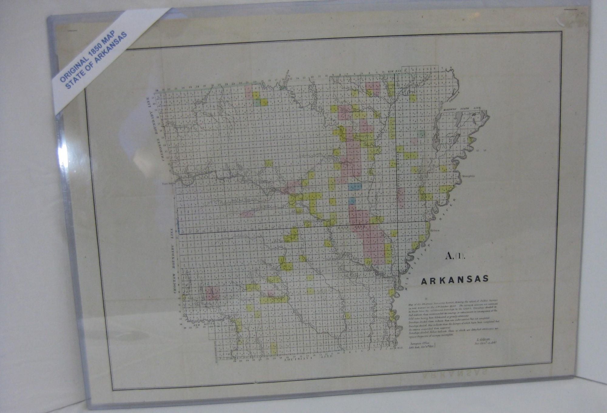
[MAP] ARKANSAS. Map Of The Arkansas Surveying District, Shewing The Extent Of Public Surveys In Said District On The 30th October 1850.
Little Rock: Surveyors Office, 1850. Imperial Edition. Map. Elephant Folio - over 15 - 23" tall. Very Good. Item #002147
1850.1st edition, thus. A Very Good copy. 23 1/2" x 17 1/2". Hand colored in 4 colors. Original folds visible. A Very Good, close to Near Fine copy. *** The townships are colored to indicate the completeness, or necessity to resurvey them. Red is recommended to resurvey, the majority of the colored townships. Green indicates those under contract, but not completed. Blue indicates surveys completed, but the returns suspended from approval. Yellow indicate those in which detached surveys or fragmented surveys. Completed in the Surveyors Office, Little Rock, Nov. 6th, 1850. OCLC locates only 11 examples of this map. ***.
Price: $150.00